
Friday, April 30, 2010


Newyork City........Geography
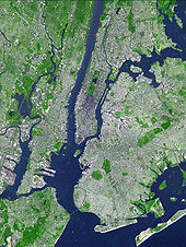
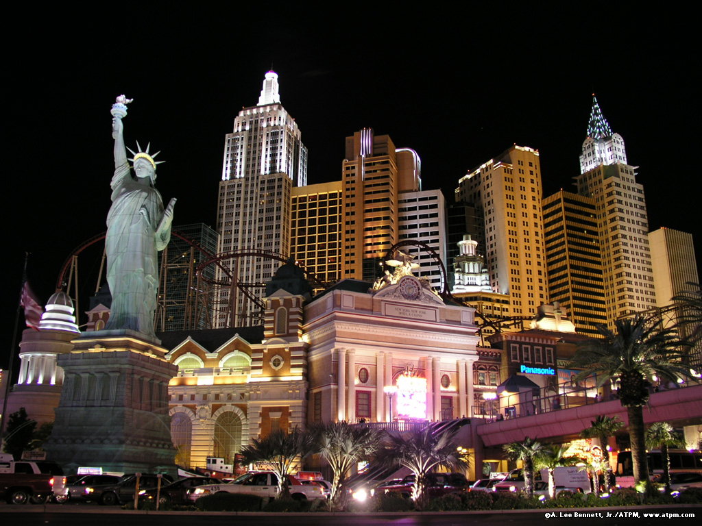
New York City is located in the Northeastern United States, in southeastern New York State, approximately halfway between Washington, D.C. and Boston. The location at the mouth of the Hudson River, which feeds into a naturally sheltered harbor and then into the Atlantic Ocean, has helped the city grow in significance as a trading city. Much of New York is built on the three islands of Manhattan, Staten Island, and Long Island, making land scarce and encouraging a high population density.
The Hudson River flows through the Hudson Valley into New York Bay. Between New York City and Troy, New York, the river is an estuary.[39] The Hudson separates the city from New Jersey. The East River – a tidal strait – flows from Long Island Sound and separates the Bronx and Manhattan from Long Island. The Harlem River, another tidal strait between the East and Hudson Rivers, separates Manhattan from the Bronx.
The city's land has been altered substantially by human intervention, with considerable land reclamation along the waterfronts since Dutch colonial times. Reclamation is most prominent in Lower Manhattan, with developments such as Battery Park City in the 1970s and 1980s.[40] Some of the natural variations in topography have been evened out, especially in Manhattan.[41]
The city's land area is estimated at 304.8 square miles (789 km2).[3][4] Its total area is 468.9 square miles (1,214 km2). 164.1 square miles (425 km2) of this are water and 304.8 square miles (789 km2) is land. The highest point in the city is Todt Hill on Staten Island, which, at 409.8 feet (124.9 m) above sea level, is the highest point on the Eastern Seaboard south of Maine.[42] The summit of the ridge is mostly covered in woodlands as part of the Staten Island Greenbelt.[43]
Climate
Under the Köppen climate classification, New York City has a humid subtropical climate and enjoys an average of 234 days with at least some sunshine annually, for an average of 2680 hours of sunshine per year.[44] When using the 0°C (American scientist standard) isotherm as criterion, it is the northernmost major city in North America that features a humid subtropical climate.Summers are typically hot and humid with average high temperatures of 79 °F (26.1 °C) to 84 °F (28.9 °C) and lows of 63 °F (17.2 °C) to 69 °F (20.6 °C), however temperatures exceed 90 °F (32 °C) on average of 16 – 19 days each summer and can exceed 100 °F (38 °C) every 4–6 years.[45] Winters are cold, and prevailing wind patterns that blow offshore minimizes the effect of the Atlantic Ocean. Yet, the Atlantic Ocean keeps the city warmer in the winter than inland North American cities located at similar latitudes such as Chicago, Pittsburgh and Cincinnati. The average temperature in January, New York City's coldest month, is 32.1 °F (0.1 °C). However temperatures in winter could for few days be as low as 10 °F (−12 °C) and as high as the 50s °F (10-15 °C).[46] Spring and autumn are unpredictable, and can range from chilly to warm, although they are usually pleasantly mild with low humidity.
New York City receives 49.7 inches (1,260 mm) of precipitation annually, which is fairly spread throughout the year. Average winter snowfall is about 28.1 inches (71 cm), but this usually varies considerably from year to year, and snow cover usually remains little.[44] Hurricanes and tropical storms are rare in the New York area, but are not unheard of and always have the potential to strike the area.
| [hide]Month | Jan | Feb | Mar | Apr | May | Jun | Jul | Aug | Sep | Oct | Nov | Dec | Year |
|---|---|---|---|---|---|---|---|---|---|---|---|---|---|
| Record high °F (°C) | 72 (22) | 75 (24) | 86 (30) | 96 (36) | 99 (37) | 101 (38) | 106 (41) | 104 (40) | 102 (39) | 94 (34) | 84 (29) | 75 (24) | 106 (41) |
| Average high °F (°C) | 38.0 (3.3) | 41.0 (5) | 49.8 (9.9) | 60.7 (15.9) | 70.9 (21.6) | 79.0 (26.1) | 84.2 (29) | 82.4 (28) | 74.7 (23.7) | 63.5 (17.5) | 53.1 (11.7) | 42.9 (6.1) | 61.7 (16.5) |
| Daily mean °F (°C) | 32.1 (0.1) | 34.6 (1.4) | 42.5 (5.8) | 52.5 (11.4) | 62.6 (17) | 71.2 (21.8) | 76.5 (24.7) | 75.1 (23.9) | 67.5 (19.7) | 56.6 (13.7) | 47.1 (8.4) | 37.3 (2.9) | 54.6 (12.6) |
| Average low °F (°C) | 26.2 (-3.2) | 28.1 (-2.2) | 35.1 (1.7) | 44.2 (6.8) | 54.2 (12.3) | 63.3 (17.4) | 68.8 (20.4) | 67.7 (19.8) | 60.3 (15.7) | 49.6 (9.8) | 41.0 (5) | 31.6 (-0.2) | 47.5 (8.6) |
| Record low °F (°C) | -6 (-21) | -15 (-26) | 3 (-16) | 12 (-11) | 28 (-2) | 44 (7) | 52 (11) | 50 (10) | 39 (4) | 28 (-2) | 7 (-14) | -13 (-25) | -15 (-26) |
| Precipitation inches (mm) | 4.13 (104.9) | 3.15 (80) | 4.37 (111) | 4.28 (108.7) | 4.69 (119.1) | 3.84 (97.5) | 4.62 (117.3) | 4.22 (107.2) | 4.23 (107.4) | 3.85 (97.8) | 4.36 (110.7) | 3.95 (100.3) | 49.69 (1,262.1) |
| Snowfall inches (cm) | 7.5 (19.1) | 8.4 (21.3) | 5.0 (12.7) | 0.9 (2.3) | 0 (0) | 0 (0) | 0 (0) | 0 (0) | 0 (0) | 0 (0) | 0.9 (2.3) | 5.4 (13.7) | 28.1 (71.4) |
| Avg. snowy days | 4.1 | 2.9 | 1.6 | 0.2 | 0 | 0 | 0 | 0 | 0 | 0 | 0.3 | 1.8 | 10.9 |
| Avg. precipitation days | 10.3 | 9.4 | 10.7 | 11.1 | 11.4 | 10.8 | 10.2 | 9.5 | 9.1 | 8.3 | 9.3 | 10.6 | 120.7 |
| Source: NOAA [47] Weatherbase.com [48] August 2009 | |||||||||||||
Environment
Mass transit use in New York City is the highest in the United States, and gasoline consumption in the city is the same rate as the national average in the 1920s.[49] New York City's high level of mass transit use saved 1.8 billion gallons of oil in 2006; New York saves half of all the oil saved by transit nationwide.[50] The city's population density, low automobile use and high transit utility make it among the most energy efficient cities in the United States.[51] New York City's greenhouse gas emissions are 7.1 metric tons per person compared with the national average of 24.5.[52] New Yorkers are collectively responsible for one percent of the nation's greenhouse gas emissions[52] though they comprise 2.7% of the nation's population. The average New Yorker consumes less than half the electricity used by a resident of San Francisco and nearly one-quarter the electricity consumed by a resident of Dallas.[53]
In recent years, the city has focused on reducing its environmental impact. Large amounts of concentrated pollution in New York City led to a high incidence of asthma and other respiratory conditions among the city's residents.[54] The city government is required to purchase only the most energy-efficient equipment for use in city offices and public housing.[55] New York has the largest clean air diesel-hybrid and compressed natural gas bus fleet in the country, and some of the first hybrid taxis.[56] The city government was a petitioner in the landmark Massachusetts v. Environmental Protection Agency Supreme Court case forcing the EPA to regulate greenhouse gases as pollutants. The city is also a leader in the construction of energy-efficient green office buildings, including the Hearst Tower among others.[57]
New York City is supplied with drinking water by the protected Catskill Mountains watershed.[58] As a result of the watershed's integrity and undisturbed natural water filtration system, New York is one of only four major cities in the United States with drinking water pure enough not to require purification by water treatment plants.[59]
Wednesday, April 14, 2010


Newyork - History
The region was inhabited by about 5,000 Lenape Native Americans at the time of its European discovery in 1524[9] by Giovanni da Verrazzano, an Italian explorer in the service of the French crown, who called it "Nouvelle Angoulême" (New Angoulême).[10] European settlement began with the founding of a Dutch fur trading settlement, later called "Nieuw Amsterdam" (New Amsterdam), on the southern tip of Manhattan in 1614. Dutch colonial Director-General Peter Minuit purchased the island of Manhattan from the Lenape in 1626 for a value of 60 guilders (about $1000 in 2006);[11] a disproved legend says that Manhattan was purchased for $24 worth of glass beads.[12][13]


In 1664, the English conquered the city and renamed it "New York" after the English Duke of York and Albany.[14] At the end of the Second Anglo-Dutch War the Dutch gained control of Run (then a much more valuable asset) in exchange for the English controlling New Amsterdam (New York) in North America. Several intertribal wars among the Native Americans and some epidemics brought on by the arrival of the Europeans caused sizable population losses for the Lenape between the years 1660 and 1670.[15] By 1700, the Lenape population had diminished to 200.[16] In 1702, city lost 10% of its population to yellow fever.[17] New York underwent no less than seven important yellow fever epidemics from 1702 to 1800.[18]
New York City grew in importance as a trading port while under British rule. The city hosted the influential John Peter Zenger trial in 1735, helping to establish the freedom of the press in North America. In 1754, Columbia University was founded under charter by George II of Great Britain as King's College in Lower Manhattan.[19] The Stamp Act Congress met in New York in October of 1765 as the Sons of Liberty organized in the city, skirmishing over the next ten years with British troops stationed there.
During the American Revolutionary War, the area emerged as the theater for a series of crucial battles known as the New York Campaign. After the upper Manhattan Battle of Fort Washington in 1776 the city became the British military and political base of operations in North America, and a haven for Loyalist refugees, until military occupation ended in 1783. A major fire during the occupation led to the destruction of about a quarter of the city. The assembly of the Congress of the Confederation made New York City the national capital shortly after the war: the Constitution of the United States was ratified and in 1789 the first President of the United States, George Washington, was inaugurated; the first United States Congress and the United States Supreme Court each assembled for the first time in 1789, and the United States Bill of Rights drafted, all at Federal Hall on Wall Street.[20] By 1790, New York City had surpassed Philadelphia as the largest city in the United States.
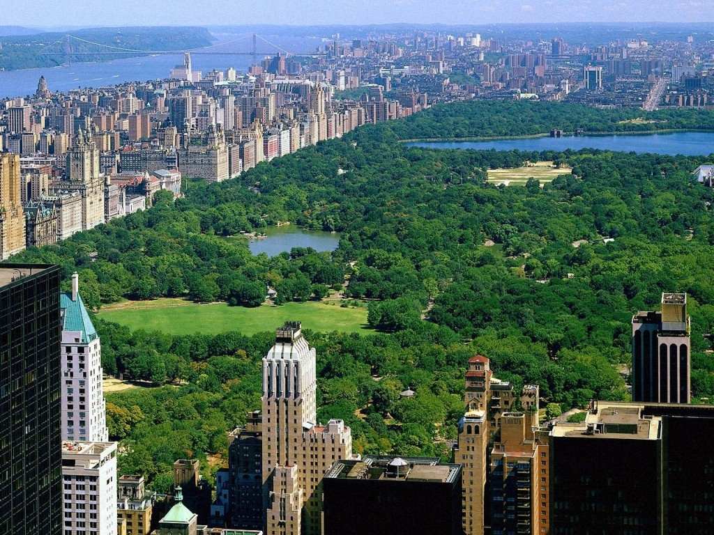
In the 19th century, the city was transformed by immigration and development.[21] A visionary development proposal, the Commissioners' Plan of 1811, expanded the city street grid to encompass all of Manhattan, and the 1819 opening of the Erie Canal connected the Atlantic port to the vast agricultural markets of the North American interior.[22] Local politics fell under the domination of Tammany Hall, a political machine supported by Irish immigrants.[23] Public-minded members of the old merchant aristocracy lobbied for the establishment of Central Park, which became the first landscaped park in an American city in 1857. A significant free-black population also existed in Manhattan and Brooklyn. Slaves had been held in New York through 1827, but during the 1830s New York became a center of interracial abolitionist activism in the North. New York's black population was over 16,000 in 1840.[24] The Great Irish Famine brought a large influx of Irish immigrants, and by 1860, one in four New Yorkers – over 200,000 – had been born in Ireland.[25]
Anger at military conscription during the American Civil War (1861–1865) led to the Draft Riots of 1863, one of the worst incidents of civil unrest in American history.[26]
Anger at military conscription during the American Civil War (1861–1865) led to the Draft Riots of 1863, one of the worst incidents of civil unrest in American history.[26]

In 1898, the modern City of New York was formed with the consolidation of Brooklyn (until then a separate city), the County of New York (which then included parts of the Bronx), the County of Richmond, and the western portion of the County of Queens.[27] The opening of the New York City Subway in 1904 helped bind the new city together. Throughout the first half of the 20th century, the city became a world center for industry, commerce, and communication. However, this development did not come without a price. In 1904, the steamship General Slocum caught fire in the East River, killing 1,021 people on board.
In 1911, the Triangle Shirtwaist Factory fire, the city's worst industrial disaster, took the lives of 146 garment workers and spurred the growth of the International Ladies' Garment Workers' Union and major improvements in factory safety standards.[28]
New York's nonwhite population was 36,620 in 1890.[29] In the 1920s, New York City was a prime destination for African Americans during the Great Migration from the American South. By 1916, New York City was home to the largest urban African diaspora in North America. The Harlem Renaissance flourished during the era of Prohibition, coincident with a larger economic boom that saw the skyline develop with the construction of competing skyscrapers.
New York City became the most populous urbanized area in the world in early 1920s, overtaking London, and the metropolitan area surpassed the 10 million mark in early 1930s becoming the first megacity in human history.[30] The difficult years of the Great Depression saw the election of reformer Fiorello LaGuardia as mayor and the fall of Tammany Hall after eighty years of political dominance.[31]

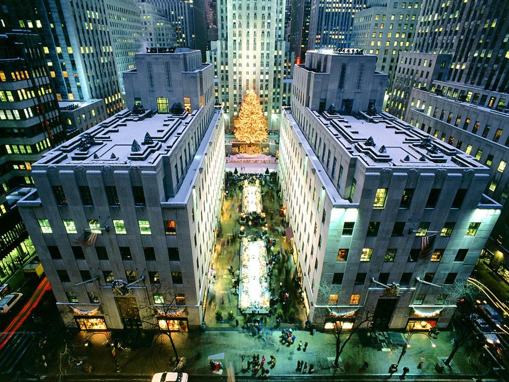
Midtown Manhattan, New York City, from Rockefeller Center, 1932
Returning World War II veterans created a postwar economic boom and the development of large housing tracts in eastern Queens. New York emerged from the war unscathed and the leading city of the world, with Wall Street leading America's ascendance as the world's dominant economic power, the United Nations headquarters (completed in 1950) emphasizing New York's political influence, and the rise of abstract expressionism in the city precipitating New York's displacement of Paris as the center of the art world.[32]
In the 1960s, New York suffered from economic problems, rising crime rates, which reached a peak in the 1970s. In the 1980s, resurgence in the financial industry improved the city's economic health. By the 1990s, crime rates dropped dramatically, many American transplants and waves of new immigrants arrived from Asia and Latin America. Important new sectors, such as Silicon Alley, emerged in the city's economy and New York's population reached an all-time high in the 2000 census.

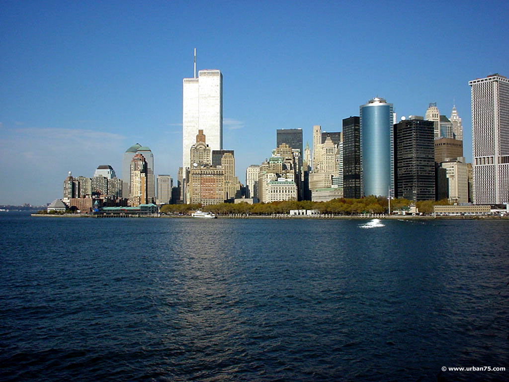
The pre-9/11 skyline of Lower Manhattan, August 2001
The city was one of the sites of the September 11, 2001 attacks, when nearly 3,000 people died in the destruction of the World Trade Center.[33] A new 1 World Trade Center (previously known as the Freedom Tower), along with a memorial and three other office towers, will be built on the site and is scheduled for completion in 2013.[34]
On December 19, 2006, the first steel columns were installed in the building's foundation. Three other high-rise office buildings are planned for the site along Greenwich Street, and they will surround the World Trade Center Memorial, which is under construction. The area will also be home to a museum dedicated to the history of the site.
February 2007 estimates put the cost for construction of 1 WTC at $3 billion, or $1,150 per square foot ($12,380 per square meter).[35] Approximately $1 billion of insurance money recouped by Silverstein is slated for construction of the Freedom Tower.[35]

A rendering of 1 World Trade Center, currently under construction.
The State of New York is expected to provide $250 million toward construction costs, and the Port Authority would finance another $1 billion for 1 WTC, through bonds.


Subscribe to:
Posts (Atom)
