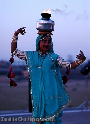
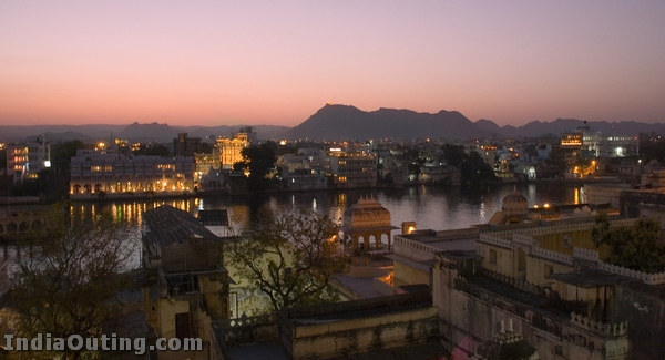
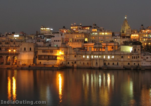
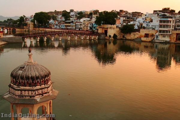
Udaipur pronunciation (उदयपुर) is a city and a municipal council in Udaipur district in the Indian state of Rajasthan. It is the historic capital of the former kingdom of Mewar, and the administrative headquarters of Udaipur District. It is also known as the City of Lakes. The Pichola lake, Fateh Sagar Lake, Udai Sagar and Swaroop Sagar in this city are considered some of the most beautiful lakes in the state.
It is known for its Rajput-era palaces. Particularly famous is the Lake Palace, which covers an entire island in the Pichola Lake. Many of the palaces have been converted into luxury hotels.
History
Udaipur was the capital of the Rajput kingdom of Mewar, ruled by Ranawats of the Sisodia clan. The founder of Udaipur was Rana Udai Singh. The ancient capital of Mewar was Chittor or Chittorgarh, located on the Banas River northeast of Udaipur. Legend has it that Maharana Udai Singh came upon a hermit while hunting in the foothills of the Aravalli Range. The hermit blessed the king and asked him to build a palace on the spot and it would be well protected. Udai Singh established a residence there. In 1568 the Mughal emperor Akbar captured Chittor, and Udai Singh moved the capital to the site of his residence, which became the city of Udaipur.
Getting In
Udaipur is well connected to the world through land, rail and air.
Road : The city falls on the Golden Quadrilateral, lying midway between Delhi and Mumbai on National Highway (NH) 8; it is around 650 kilometres from either metro. The roads in this part of the country are paved and fit for private vehicles. One can either drive from Jaipur (around 6 hours) or Ahmedabad (3.5 hours), or take a Rajasthan Tourism bus from India Gate in Delhi. It also falls on East West Corridor which starts from Porbandar and ends at Silchar and is intersecting the Golden Quadrilateral and shares the common space from Udaipur to Chittor.
Air : Dabok airport, also known as Maharana Pratap Airport, is 24 kilometres from the city centre. Daily Indian Airlines flights connect Udaipur with Jodhpur, Jaipur, Aurangabad, Mumbai & Delhi. There are daily flights from Delhi, Mumbai and Jaipur on Jet Airways, Indian Airlines and Kingfisher Airlines. The airport is going through modernisation project and will soon have a new terminal building with an additional 4 stands. The airport has been confirmed as an International airport by the Government of India.
Train : Train connectivity is established between Delhi, Jaipur and Ahmedabad through trains run by Indian Railway. Recently Udaipur got connected with Delhi, Kota and Mathura with the “Mewar Express” on broadgauge tracks. In August 2007 Udaipur was connected with Kolkatta, by the “Ananya Express”. A train has also been introduced between Mumbai and Udaipur via Vadodara, Ratlam and Chittorgarh. Udaipur lacks direct connectivity to South India, and one has to reach it either via Kota or Ahmedabad.
Local transport : Unmetered taxis, auto rickshaws, tongas, city bus, and regular city bus service is available for Udaipur City main roads to Dabok Airport, Badi Lake, and Bedala.
Places of interest
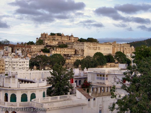
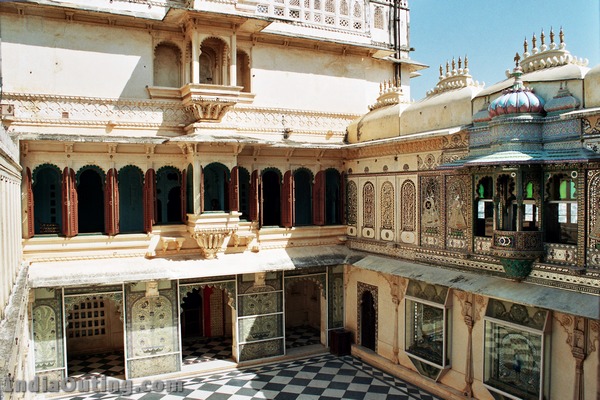
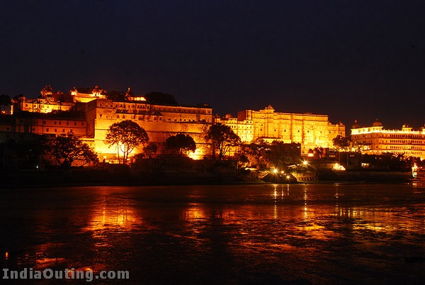
City Palace Udaipur
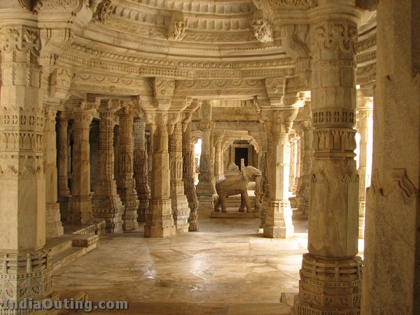
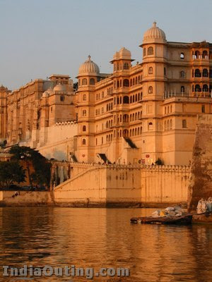
Standing on the east bank of Lake Pichola is a massive series of palaces built at different times from 1559. The balconies of the palace provide panoramic views of “Jag Niwas” (the Lake Palace Hotel), Jag Mandir on one side and on the other the city of Udaipur. Its main entrance is through the triple-arched gate – the Tripolia, built in 1725. The way now leads to a series of courtyards, overlapping parations, terraces, corridors and gardens. There is a Suraj Gokhda, where the maharanas of Mewar presented themselves in the times of trouble to the people to restore confidence. The Mor-chowk (Peacock courtyard), gets its name from the mosaics in glass decorating its walls. The chini chitrashala is noteworthy while a series of wall paintings of Krishna are on display in Bhim Vilas. There are numerous other palaces such as Dilkhush mahal, Sheesh mahal, Moti mahal and Krishna vilas – in memory of a princess of striking beauty who poisoned herself to avert a bloody battle for her hand by rival princes. Now the palace contains many antique articles, paintings, decorative furniture and utensils and attracts thousands of visitors every day. The former guesthouse of the city palace, Shiv Niwas and the Fateh Prakash Palace have been converted into heritage hotels.
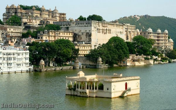
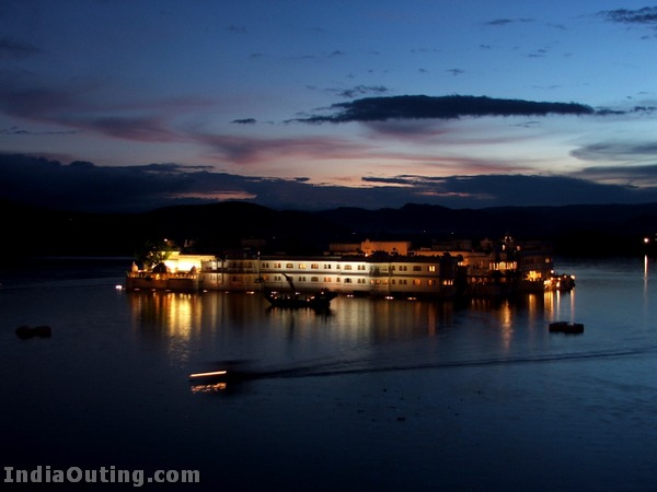
Lake Palace
Originally known as the Jag Niwas, took three years to build and was inaugurated in 1746. Nothing but marble is used in the composition of this palace. Lake Palace is now a luxury hotel owned by Taj Group of Hotels.
Jag Mandir
Another island in the Lake Pichola, which is known for its garden courtyard. Shah Jahan took refuge here while revolting against his father.
City Palace and Museum
Pratap Museum, While entering the City palace the straight way go to the Government Pratap Museum housed with old sculptures and inscriptions. The antique paintings of Mewar, the turban of prince Khurram later on called Shah Jahan, who built the world famous Taj Mahal has also been displayed here as a token of friendship of Maharana Khazan Singh. Next to Fateh Prakash Palace, houses glass and mirror works.
Bharatiya Lok Kala Mandal
A museum of folk arts. Also hosts puppet shows in its auditorium.
Maharana Pratap Memorial or Moti Magri
Atop the Moti Magri or Pearl Hill, overlooking the Fateh Sagar Lake is the memorial of the Rajput hero Maharana Pratap with a bronze statue of the Maharana astride his favourite horse “Chetak”. More details are available at Maharanapratap.net, a collection of facts and figures on Maharana Pratap and his life.
Sajjangarh Fort
The summer resort of the Maharajas is atop the hill overlooking all the lakes. This palace had a way to collect rain water for consumption all year around.
Sukhadia Circle
Sukhadia Circle (Square), Udaipur, a large roundabout in the city’s northern suburb of Panchwati, on the road to Ranakpur and Mt. Abu. The centrepiece of the Circle is a large, three-tiered fountain just over 21 m. high, with scalloped dishes surmounted by a wheat-ear motif, representing prosperity. Illuminated at night, it is now a well-known landmark. Its foundation was laid in 1968 and was opened in 1970. The Circle is a popular recreational centre and meeting place. A circular pond surrounds the fountain; nearby are pleasant gardens. Families and friends come together, especially at night, when music plays, and dozens of food, cold drinks and tea stalls do a flourishing trade. Children particularly enjoy the experience: they float toy boats in the central pond, where odd duck-shaped pedallos (paddle boats) vie for space; there is even a mini train nearby. Sukhadia Circle commemorates the memory of Udaipur’s MOHAN LAL SUKHADIA, one-time Chief Minister of Rajasthan and a native of Udaipur.
Jagdish Temple
A temple situated in the middle of the city – a big tourist attraction, the temple of Jagannath Rai, now called Jagdish-ji, is a major monument. It is raised on a tall terrace and was completed in 1651. It attaches a double storeyed Mandapa (hall) to a double – storied, saandhara (that having a covered ambulatory) sanctum. The mandapa has another storey tucked within its pyramidal samavarna (bell – roof) while the hollow clustered spire over the sanctum contains two more, non – functional stories. Lanes taking off from many of the sheharpanah (city wall) converge on the Jagdish Temple. It was built by Maharana Jagat Singh Ist in 1651 A.D. It is an example of Indo – Aryan architecture.
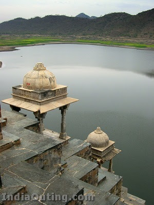
Fateh Sagar Lake
Fateh Sager Lake is a vicinity for young lovers, it is situated in the north of Lake Picholas. It was originally built by Maharana Jai Singh in the year 1678 AD, but later on reconstructed and extended by Maharana Fateh Singh, As lot of destruction was caused by heavy rains.In the year 1993-1994,the water vanished from the lake and again in the year 2005-2006, the lake regaind its water.The lake is tried directly to connect with mansivacal dam so that it doesnot suffer any type of water problem again in future.
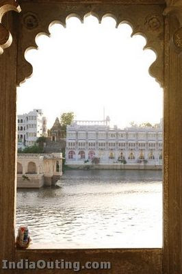
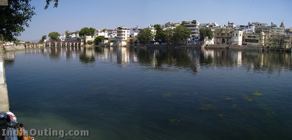
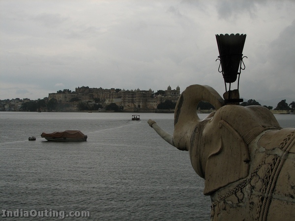
Lake Pichola
The Sapphire Udaipur : Lake Pichola is a lake that has two islands, Jag Niwas and the Jag Mandir. This lake is 4km long and 3 km wide, originally built by Maharana Udai Singh II after he discovered Rajasthan “Udaipur”. There are many ghats, like the bathing and washing ghats, which can be approached through boats from the City Palace of Udaipur (Bansi Ghat). In the heart of lake, the Lake Palace stands, which is now converted into a heritage palace hotel. This palace hotel is considered to be 3 decades old in the history of Udaipur. The Lake remains fairly shallow, at the time of heavy rains, and gets dry easily at the time of severe drought. A hermit is said to have advised the Maharana to establish his kingdom over Lake Pichola, after the fall of Chittaurgarh by Mughal emperor Akbar.
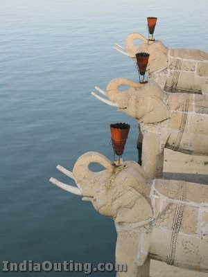
Saheliyon-ki-Bari
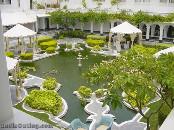
Sahelion Ki Bari’ was laid for a group of forty-eight young women attendants who accompanied a princess to Udaipur as part of her dowry. The gardens set below the embankment of the Fateh Sagar Lake have beautiful lotus pools, marble pavilions and elephant- shaped fountains. These fountains are fed by the water of the lake gushing through ducts made for the purpose. Each water channel has its distinct sound and the mingling of these sounds complement the ambience of the place.
Udaipur Solar Observatory
Asia’s only solar observatory, the Udaipur Solar Observatory is situated on an island in the middle of the Lake Fatehsagar and the main office building is located at its NW-shore near Bari Road – Rani Road Junction. The site is run under PRL (Physical Reaserch Lab) in Ahemdabad. The sky conditions at Udaipur are quite favourable for solar observations. The large water body surrounding the telescopes decreases the amount of heating of the surface layers. This decreases the turbulence in the air mass and thereby improves the image quality and seeing. The main objective of obtaining the high spatial and temporal resolution observations of solar photospheric and chromospheric.